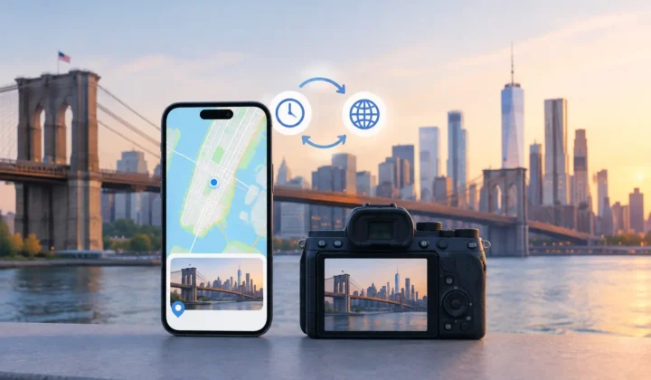
A scanned family photo can be technically perfect and still feel incomplete. You may recognize the people, the season, even the occasion, yet Apple Photos cannot place it beside the trip, home, or neighborhood where it belongs. A photo metadata editor can restore that context, but location is not a field to fill casually. Once a pin is attached to a memory, it can shape how you find, group, and understand it for years.
The right tool treats metadata as part of the record, not as disposable administrative detail. It should help you correct what is supported by evidence, show you what is uncertain, and leave the final decision with you.
What a photo metadata editor actually changes
Photo metadata is information stored with an image or maintained by a photo library. It can include the capture date and time, camera model, lens details, copyright information, captions, keywords, and geographic coordinates. A photo metadata editor lets you inspect or change some of those fields.
For many personal libraries, location is the missing piece that matters most. Location turns a sequence of otherwise disconnected images into a searchable record: photos from a particular city, pictures at a childhood home, or every image from a family vacation. It also makes map and Places views more useful without requiring you to remember exact dates years later.
But editing metadata is not always the same as editing pixels. A trustworthy workflow makes that distinction clear. Changing a location should not quietly alter the image itself, strip camera information, or overwrite a more reliable date. Before using any editor, understand whether it updates your library’s location record, writes into an exported file, or does both. The choice depends on whether your priority is organizing Apple Photos, preparing files for an archive, or sharing corrected copies elsewhere.
A location pin needs evidence, not optimism
The most tempting approach to missing location data is also the weakest: select a large batch of photos and assign one broad place. That can be appropriate when you know every image was made at the same event. It becomes risky when a batch spans travel, multiple stops, or several days.
A better photo metadata editor starts with the timeline. If an untagged image sits between two geotagged photos taken four minutes apart at the same location, the case for placing it there is usually strong. If it sits between anchors six hours apart in different cities, a single proposed location would be unsupported guessing.
Those are not edge cases. They are the difference between useful automation and false certainty.
Photo Geotag approaches missing locations as an evidence problem. It examines untagged images in the context of neighboring photos with known locations, then groups related proposals for review. A proposal should show its anchor images, the relevant time gap, and an explicit certainty state. When the evidence cannot justify a confident pin, the app should say so rather than drawing one that looks authoritative.
That restraint matters most with old scans and imported camera files. A scan may receive the date it was digitized rather than the date the original was taken. A Canon, Nikon, Sony, or Fujifilm file may have a reliable capture time but no GPS coordinate. AirDrop and messaging apps can preserve some details while dropping others. Each situation calls for a different level of confidence.
Certainty should be visible before you apply a change
A useful interface does more than present a map pin. It explains why that pin is being proposed. The practical signals are simple: nearby geotagged anchors, their timestamps, the time distance from the untagged photo, and the scale of the timeline being reviewed.
Color-coded certainty can help you move through a large library efficiently, provided it is not treated as a substitute for evidence. High-confidence groups may be suitable for fast confirmation. Lower-confidence groups deserve a closer look or a manual location. Images with no defensible basis for placement should remain untagged until you can identify them yourself.
This is also why grouped review is better than a stream of isolated prompts. A dozen photos from the same untagged interval often tell a clearer story together than they do one at a time. You can see whether they belong to the same walk, meal, or visit, then confirm or adjust the group with context intact.
The camera clock can be the hidden problem
Time-based location inference depends on correct capture times. Dedicated cameras are especially prone to small clock errors after daylight saving changes, international travel, battery replacement, or simple neglect. A camera that is 45 minutes behind can make otherwise sensible location matching appear wrong.
A careful editor should detect patterns that suggest a clock offset instead of forcing locations onto the wrong points in a timeline. For example, perhaps every camera image falls consistently between GPS-tagged iPhone photos, but the visual sequence only makes sense after shifting the camera timestamps by one hour. That is a problem worth surfacing for review.
Clock correction is not a cosmetic setting. It can affect an entire imported shoot. Treat it as a deliberate, previewable operation, and check a few recognizable images before applying it broadly. If the evidence is mixed, correct smaller ranges rather than assuming one offset applies to every file.
Privacy is part of metadata integrity
Photos often contain more personal information than their visible pixels suggest. Locations can reveal home addresses, schools, routines, places of worship, and travel patterns. A photo metadata editor that requires cloud uploads or account creation asks you to hand over information that may be more sensitive than the image itself.
For Apple-platform users, local processing is a meaningful design choice. The app can examine the timeline and propose location repairs on your iPhone, iPad, or Mac without sending your photo library to a remote service for analysis. That keeps both the images and the surrounding context under your control.
Local processing does not eliminate the need for caution. Review permissions carefully, especially if an app requests broad library access. Prefer tools that make their scope clear, process only what is needed for the task, and do not require an account merely to inspect your own collection.
A safer workflow: scan, confirm, apply
The best metadata work follows a simple sequence, but each stage has a different job.
Scan for gaps with context
Start by identifying photos that lack locations rather than trying to repair everything at once. Look for predictable sources of gaps: scanned prints, indoor images where the phone never acquired GPS, photos saved from WhatsApp, and imports from a dedicated camera.
The scan should place those gaps in a timeline beside known-location photos. This turns a vague cleanup project into specific intervals you can evaluate. A missing location between two matching anchors is different from a missing location at the beginning of a trip with no nearby reference.
Confirm what the evidence supports
Review proposed groups against the photos themselves. Look for visual cues such as a hotel room, a restaurant, a landscape, or the people present. Use the map and anchor photos together. If the proposed place is generally right but too broad or slightly off, edit it manually before applying.
Do not feel obligated to resolve every image. Leaving a photo untagged is often more accurate than assigning a plausible but unproven location. That is particularly true for digitized family archives, where the surrounding date may be reliable while the place is not.
Apply changes with a way back
Metadata editing should be explicit, not silent. You should know which photos will change and be able to reverse a decision if later evidence contradicts it. A journal of writes or a reliable undo path is valuable when working through hundreds of images, because even a careful review can uncover new information later.
For a large library, work in natural segments: one vacation, one camera import, or one box of scanned prints. This makes patterns easier to see and limits the consequences of an incorrect assumption. It also creates a useful stopping point when the evidence becomes thin.
Choose control over a quick-looking result
A good photo metadata editor does not promise that every missing field can be repaired. Some photographs simply have no trustworthy connection to a time or place. The useful promise is narrower: where the library provides evidence, the tool can help you see it, assess it, and make a reversible decision.
That standard protects more than map accuracy. It protects the credibility of the library you are building for yourself and for the people who may inherit it. A photo that remains honestly unknown still has room for a future discovery. A confidently wrong pin can be much harder to notice.