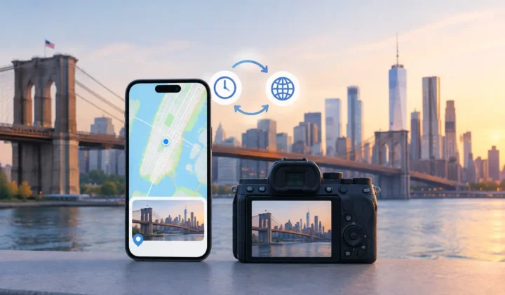
A photo can be perfectly exposed and still feel incomplete when it has no place attached to it. You remember the lake, the museum, or the kitchen where a birthday happened. Apple Photos does not. To recover photo places automatically without turning memory organization into a guessing game, the evidence behind each proposed location matters as much as the result.
Location metadata commonly disappears in ordinary ways. A scanned print begins with no GPS data. An image saved from WhatsApp or AirDrop may lose its original location. A phone photo taken indoors may never obtain a GPS lock. Imports from Canon, Nikon, Sony, and Fujifilm cameras often arrive with accurate capture times but no coordinates at all.
The tempting answer is to put every untagged image on a map. That is also how an organized library becomes a less trustworthy one. A useful system should distinguish between a location supported by the timeline and a location that would simply be convenient to assign.
Why automatic location recovery needs restraint
A timestamp is not a location. But it can become strong evidence when it sits between two photos with known locations.
Imagine an untagged photo captured at 2:04 PM. The photo before it was taken at 2:02 PM at a botanical garden, and the next one was taken at 2:06 PM at the same garden. The timeline has a small gap, the anchor photos agree, and the proposed placement is understandable.
Now change that gap to six hours. The same two coordinates no longer establish where the missing photo belongs. You may have driven across town, taken a flight, or simply left the camera at home before importing its files later. An automatic pin in that situation is not helpful inference. It is unsupported certainty.
This distinction is especially valuable in a large library. A few incorrect locations may not seem serious until a search for a family trip, a favorite park, or an old address returns images that were never taken there. Metadata should make memories easier to find, not create a second version of their history.
Recover photo places automatically from timeline evidence
The safest workflow starts with a scan of the existing library, not a request to upload photos somewhere else. The app looks for images without location data and examines their place in the timeline relative to photos that do have coordinates.
The relevant question is not simply, “What place is nearest?” It is, “What does the surrounding evidence justify?” Capture time, the distance between known locations, the duration of the gap, and whether neighboring photos agree all affect the answer. A series of images taken minutes apart at one venue may support a grouped proposal. An isolated file between conflicting anchors may not.
Grouping is more than a convenience. If forty imported camera photos were taken during the same walk, reviewing forty individual map pins is slow and makes it easy to miss a bad assumption. A grouped proposal lets you inspect the time range, the nearby geotagged anchor photos, and the suggested place as one piece of evidence.
For photos that do not meet the threshold, the correct result may be no proposed pin at all. That can feel less automatic, but it preserves the difference between a known place and an unknown one. Photo Geotag is designed around this boundary: never a confident pin it cannot justify.
Capture time must be trustworthy
Dedicated cameras introduce a complication that phone-only libraries often avoid: camera clocks drift. A camera set to the wrong time zone, or left several hours behind after travel, can place a perfectly real photo in the wrong part of the timeline.
Without clock correction, an inference tool might compare a morning camera image with the wrong phone photos and produce a plausible-looking but incorrect location. Good recovery software should detect patterns that suggest an offset, show the proposed correction clearly, and let you review it before using that timing to infer locations.
This is also why automatic recovery should not treat file import time as capture time. The day you copied a memory card to your Mac says very little about where the images were made. The original capture timestamp is the useful clue, provided the camera clock has been checked.
Review proposals before changing your library
The word “automatic” should describe the analysis, not a silent write to your photo library. A careful workflow has three stages: Scan, Confirm, Apply.
During Scan, untagged images are found and organized around evidence in the timeline. During Confirm, you inspect each proposed location. The interface should make uncertainty visible rather than hiding it behind polished map imagery. Color-coded certainty states, timeline scale, capture times, and identifiable anchor photos help answer a simple question: does this proposed place fit what I know?
A map pin alone is weak context. Seeing that two surrounding images were taken on the same street four minutes before and after the missing image is much stronger. Conversely, seeing anchors hours apart or in different locations gives you a reason to reject the proposal.
During Apply, only the proposals you approve are written to the library. The process should be journaled so changes are traceable and reversible. If you later recognize that a batch belongs at a different trailhead, a different city, or nowhere specific, you should be able to correct it without trying to reconstruct what the app changed weeks earlier.
Manual editing still has a place in an automatic workflow. A family archivist may know that a set of scanned photos was taken at a particular house even though the original negatives provide no usable timestamps. A traveler may remember a stop that sits between two geotagged cities. In these cases, manual placement is honest because it comes from the person who knows the memory, not from software presenting an inference as fact.
Cases where the app should leave a photo unplaced
Not every missing location can be recovered from a timeline. A long interval between anchor photos, a sudden jump between distant locations, missing or unreliable capture times, and a camera-clock mismatch that cannot be resolved all limit what can be inferred.
There are also privacy choices. You may know exactly where an image was taken and still prefer not to add a precise location to your library. A home, a child’s school, a medical office, or a sensitive trip can deserve less detail or no location at all. The ability to decline a proposal is part of control, not a failure of automation.
When evidence is thin, leave the image unplaced or assign a location manually at the level that makes sense. A city may be appropriate where a street address would overstate precision. The goal is useful organization with an accurate record of what is known.
Keep personal photos on your own devices
Location recovery involves two sensitive records at once: images and a history of where they were taken. That is a poor fit for services that require a new account, cloud uploads, or remote processing simply to analyze timestamps.
For Apple users, an on-device workflow keeps the analysis close to the existing library on iPhone, iPad, or Mac. The photos remain where you keep them, while the review process remains visible. No network processing is needed to inspect your timeline, compare anchors, or decide whether a location proposal deserves approval.
Privacy and accuracy reinforce each other here. When your library is processed locally and every proposed change is shown before it is applied, you retain both the data and the judgment. That matters most with old family archives and long personal libraries, where the details are personal and the corrections may endure for years.
The best recovered location is not the one that fills the most empty map pins. It is the one you can look at later, understand why it was assigned, and still trust.