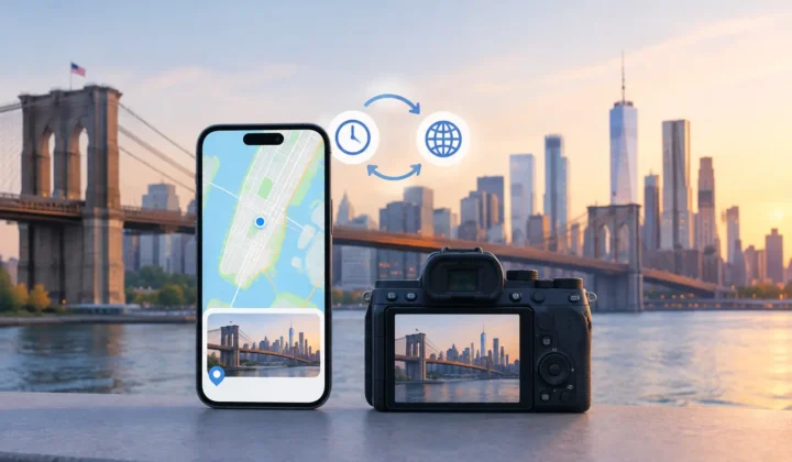
A photo can survive for decades and still lose the detail that makes it findable: where it was taken. A private offline photo metadata editor addresses that gap without asking you to upload a family library, create an account, or hand your memories to an opaque matching system. But privacy alone is not enough. The editor also has to know the difference between a location it can justify and one it can only guess.
That distinction matters most in a large Apple Photos library. A scanned print may have a date but no place. An image saved from WhatsApp or AirDrop may arrive without its original GPS data. Indoor photos often have no reliable location because the phone could not acquire a GPS lock. Dedicated-camera files from Canon, Nikon, Sony, and Fujifilm commonly have excellent timestamps but no location at all.
The temptation is to fill every empty field. The responsible approach is to restore context only when the surrounding evidence supports it, and to leave uncertain photos for review.
Why Offline Processing Changes the Decision
Photo metadata is not trivial information. A location can identify a home, a school, a workplace, a medical visit, or a regular travel pattern. Even when a service promises protection, uploading a library creates an additional copy of deeply personal material and requires trust in account systems, retention policies, and remote processing.
An offline workflow keeps the analysis on your iPhone, iPad, or Mac. Your photos remain in the existing library, and the app does not need to transmit thumbnails, timestamps, or location history to a server to make a proposal. This is particularly relevant for family archivists working with generations of images, and for photographers whose libraries include client-adjacent work or unreleased travel material.
There is also a practical benefit. Local processing can work without depending on a connection, and it makes the workflow easier to inspect. The question is not, “What did a cloud service decide?” It is, “What evidence in my library supports this proposed place?”
Privacy does not automatically make an editor accurate, however. A local tool can still make careless changes if it treats any nearby photo as proof. The quality standard should be higher: make a proposal when the timeline supports it, communicate uncertainty when it does not, and never silently write a location.
What a Private Offline Photo Metadata Editor Should Show You
A trustworthy editor should not present a pin as a fact simply because it found one possible explanation. It should expose the anchors behind the decision: the geotagged photos before and after an untagged group, their timestamps, their locations, and the size of the gap between them.
Consider two photos taken four minutes apart. If the first is tagged at a restaurant and the next is also tagged at that restaurant, an untagged image between them has a strong case for the same location. Now consider a six-hour gap between a morning image in one city and an evening image in another. Assigning every photo in that interval to either endpoint would be unsupported guessing.
A good interface makes this difference visible. Timeline scale matters because a four-minute interval and a six-hour interval should not look equally persuasive. Color-coded certainty can help, provided the labels are not used to hide ambiguity. A clear state such as “supported,” “needs review,” or “insufficient evidence” is more useful than false precision.
Grouping prevents repetitive work
Missing locations often occur in runs rather than isolated files. A batch of imported camera images from one afternoon may sit between two geotagged iPhone photos. A group proposal lets you inspect the surrounding evidence once, then apply a decision to the related images together.
Grouping should not erase individual control. You may know that most photos were taken at a museum while one was captured on the walk back to the car. The editor needs to let you adjust a proposed location, split a group, or decline the suggestion entirely before writing changes.
Clock errors need their own safeguard
Dedicated cameras introduce another complication: their clocks are often wrong. A camera may be set to the wrong time zone, drift by several minutes, or retain daylight-saving settings from a previous trip. If the editor assumes the timestamp is exact, it may compare the image against the wrong section of the phone timeline and produce a plausible but incorrect location.
Clock-offset detection is therefore not an optional extra. The software should identify a consistent mismatch between camera images and nearby geotagged anchors, show the suspected offset, and let you confirm or correct it. A corrected timeline can turn a weak proposal into a justified one. If the evidence remains weak after correction, no confident pin should appear.
A Careful Workflow: Scan, Confirm, Apply
The right workflow is deliberately simple, but each stage carries a different responsibility.
Scan the library for evidence
The scan identifies images with missing location metadata and examines their position among photos that already have a location. It looks at time, neighboring anchors, and continuity in the surrounding timeline. It should not assume that an empty location field is an invitation to invent one.
This approach is useful because personal libraries tend to contain their own reference points. You may have taken a geotagged iPhone photo before lunch, imported a series from a GPS-free Fujifilm camera, then taken another geotagged iPhone photo afterward. The existing library provides the context. No external image recognition service is required.
Confirm proposals in context
Review is where automation earns trust. You should be able to see the untagged images alongside the photos that support the proposal, understand the time window, and inspect the suggested point before anything changes.
Some proposals will be obvious. Others will require your knowledge: perhaps the timeline suggests your home, but you remember the images came from a neighbor’s house two blocks away. Manual editing is not a failure of the system. It is the correct path whenever your memory is stronger than the available metadata.
Photo Geotag is built around this reviewable model. It groups proposals, shows the evidence from nearby photos, communicates certainty explicitly, and leaves unsupported images unpinned rather than turning uncertainty into an authoritative-looking map point.
Apply changes with a way back
Metadata edits can affect how a library is searched, displayed on a map, and shared. That is why writes should be explicit and journaled. You should know what will change before applying it, and you should have a reliable way to undo a mistaken decision.
Reversibility is especially valuable when working through years of material. You may start conservatively, apply only high-confidence groups, and return later to images that need more research. A careful editor supports that pace. It does not pressure you to complete every blank field in one session.
When Inference Is Useful, and When It Is Not
Location inference works best when photos form a coherent sequence with nearby anchors. Travel days, family outings, and dedicated-camera imports paired with occasional phone shots are strong candidates. The timestamps create a narrative that can be checked.
It is less reliable when the timeline has long gaps, when photos were imported with altered capture dates, or when several people’s libraries were merged. A photo taken during a cross-country flight, for example, may fall between two locations without belonging to either one. An honest editor should flag the ambiguity or leave the field empty.
The same restraint applies to scanned prints. A scan date is not the date the original photo was taken. Unless the capture date has been corrected and placed meaningfully within a timeline, neighboring digital images may offer no valid evidence at all. In that case, manual location entry or a deliberate decision to leave the photo untagged is safer than automation.
Choose Control Over Complete-Looking Maps
A map full of pins can feel satisfying, but completeness is not the same as accuracy. Incorrect metadata is harder to notice later because it looks finished. It can distort searches, misrepresent a trip, and make family archives less trustworthy over time.
The better outcome is a library whose locations mean something. Use high-confidence proposals to remove repetitive work. Review the middle cases with the timeline in view. Keep uncertain photos untagged until you have better evidence, whether that comes from memory, a handwritten album note, or another image in the sequence.
A blank location is an honest record of what your library does not yet know. A private, offline editor should help you change that only when the evidence is there – and leave the final decision with you.