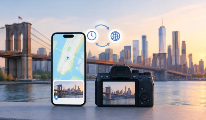
A beach photo appears between two images from the same afternoon, yet Apple Photos places it nowhere. A scanned family print has a date but no place. A Canon file lands in your library with every setting intact except GPS. To repair iPhone photo coordinates well, you need more than a map pin and a guess. You need evidence that the location belongs to that specific memory.
Location metadata makes a large photo library usable. It lets you revisit a trip by place, find the photos from a childhood home, separate two similar-looking parks, and preserve context for people who may inherit the library later. But coordinates are also factual claims. Adding them casually can make a library look more complete while making it less trustworthy.
The right workflow is therefore not simply automatic geotagging. It is a process of finding gaps, examining the surrounding evidence, confirming a proposed location, and retaining a clear path to correct or undo a change.
Why iPhone photo coordinates go missing
An iPhone normally records a location when Camera has permission and can establish a useful GPS position. That does not happen in every situation. Indoor photos, dense cities, underground spaces, and moments immediately after opening the camera can lack a reliable location fix. Privacy settings may also prevent the camera from saving location data.
Other gaps are created after the photo is taken. Images saved from WhatsApp or another messaging app may arrive without their original location. AirDropped files can have metadata stripped depending on how they were shared. Screenshots are usually tied to the device rather than the scene, so assigning them a geographic location often has little archival value.
Imported camera files are another common case. Canon, Nikon, Sony, and Fujifilm cameras can record excellent image data without recording where the shutter was pressed. A scan of a print has the same problem in a different form: it may preserve the old image, but its file creation date reflects the scan, not the day the photograph was made.
These scenarios should not be treated as one problem. A photo taken between two well-located iPhone images may have strong evidence for a repair. A scan from an undated box of prints may not. The distinction protects the integrity of the library.
Start with the evidence around each gap
Time is often the most useful clue, but only when read in context. Consider three iPhone photos taken at 2:03 PM, 2:07 PM, and 2:11 PM. The first and third have coordinates from the same museum. The untagged image in the middle likely belongs there too, especially if all three are visually consistent.
Now change the gap to six hours. A photo at 9:00 AM in Chicago and another at 3:00 PM in Milwaukee do not establish where an untagged image at noon was taken. It might be from either city, from the road between them, or from somewhere else entirely. A useful tool should recognize that the same basic pattern has become weak evidence.
Look for anchor photos on both sides of an untagged sequence. An anchor is a nearby image with a known time and location. Strong proposals usually have anchors that are close in time, geographically compatible, and part of the same apparent event. A sequence of photos from a restaurant, a walk, and a hotel may deserve separate proposals even if all occurred on the same day.
Visual context can help with review, but it should not be used to manufacture certainty. A generic indoor room does not prove a city. A recognizable landmark may support a location you already know, but it still deserves an explicit check before metadata is written.
Repair iPhone photo coordinates in a reviewable workflow
The safest practical approach has three stages: scan, confirm, and apply. Keeping those stages separate matters. It prevents a discovery tool from becoming an unchecked editing tool.
Scan for likely gaps
First, identify photos without coordinates and place them on a timeline next to geotagged images. The timeline should make the scale visible. A four-minute gap and a six-hour gap cannot be evaluated the same way, and a system that hides that difference asks users to trust too much.
Group related untagged photos when the evidence indicates they belong together. This reduces repetitive work. If twelve images were taken over ten minutes during one stop on a road trip, reviewing one proposed location for the group is more useful than dragging twelve separate pins.
A careful scan should also flag possible camera-clock problems. Dedicated cameras are often set to the wrong time zone, left on daylight saving time, or simply a few minutes fast. If imported camera files appear consistently offset from the iPhone timeline, correct the clock relationship before assigning locations. Otherwise, a sound method can produce a plausible but wrong answer.
Confirm certainty before writing anything
A proposal should say what it knows and what it does not know. High-confidence cases may be supported by close anchors on both sides with matching locations. Moderate cases may have a nearby anchor but enough elapsed time to warrant scrutiny. Low-confidence cases should remain suggestions, not decisions.
Never a confident pin it cannot justify is a useful standard. If the evidence is incomplete, leave the image untagged or set the location manually based on your own knowledge. An empty location field is more honest than a precise-looking coordinate attached to the wrong place.
During review, compare the proposed place with the photos themselves and with the wider day. If the proposal says a vacation image belongs at an airport, but the photo clearly shows a hotel room later that evening, inspect the sequence. The problem may be a clock offset, a travel interval, or an incorrect anchor photo.
Manual editing remains essential. You may remember that a set of family photos was taken at a particular house, even when no nearby GPS record exists. In that case, selecting the location yourself is appropriate because the source of certainty is your knowledge, not an inference engine. The interface should make that distinction clear.
Apply changes with control and a record
Only after review should location changes be written to the photo library. The application step should be deliberate, with the affected photos and proposed location visible before confirmation. Silent bulk edits are fast, but speed is not the same as care.
Reversibility is equally important. Metadata repairs should be journaled so you can understand what changed and undo a group of edits if a later review reveals a mistake. This matters most in a large library, where a single incorrect assumption can affect hundreds of photos.
Photo Geotag follows this evidence-based model on iPhone, iPad, and Mac. It works with the existing Apple Photos library, finds untagged images between geotagged anchors, presents grouped proposals, and keeps the review and writing process on-device. It does not need an account or a cloud upload of personal photos to inspect the timeline.
Cases that need a different method
Not every missing coordinate should be inferred from neighboring pictures. Scanned prints often need a different approach because their digital timestamps reflect scanning rather than capture. Group them by a known event, location, or album, then assign a place manually only when you can support it. For uncertain prints, a broad location such as a city may be more appropriate than an exact address, if your photo app supports the level of precision you want.
For imported camera photos, first establish whether the camera clock is accurate. Compare several camera images with iPhone images from the same event. If the camera was exactly one hour behind, a consistent correction may align the sequences and make valid proposals possible. If the time difference changes across a trip, do not assume one adjustment will fix every file.
Travel days deserve special restraint. Airports, flights, trains, and long drives create gaps where time is a poor proxy for place. Even when two anchors are valid, the location between them may be unknowable. Keep those photos untagged until you can identify them from the image, an itinerary, or personal memory.
Privacy is part of accurate photo organization
A photo library can reveal home addresses, routines, schools, and travel history. Repairing metadata should not require giving a third party a copy of those records. On-device processing keeps the timeline and location evidence under your control, and it avoids turning a personal archive into uploaded material that must be trusted to someone else’s systems.
Privacy also supports better judgment. When review happens directly in your own library, you can use context that no external service has: the album names you created, the people you recognize, and the memories behind a particular sequence. The tool can organize the evidence, but you remain the person responsible for the final claim.
A well-repaired library does not have a pin on every photo. It has locations where the evidence supports them, clear manual choices where your knowledge fills the gap, and no fabricated certainty where neither exists. That is the kind of organization that will still make sense when you return to these memories years from now.